| Slow Way | Route | To do | ||||||||
|---|---|---|---|---|---|---|---|---|---|---|
Banstead—Netherne On-The-Hill
|
Bannet two |
|
U U |
|
Survey me | Distance 8km/5mi | Ascent 156m | Descent 152m | ||

Netherne On-The-Hill—Caterham
|
Netcat one |
|
U U |
|
Survey me | Distance 6km/4mi | Ascent 142m | Descent 110m | ||

Netherne On-The-Hill—Caterham
|
Netcat two |
|
U U |
|
Survey me | Distance 6km/4mi | Ascent - | Descent - | ||

Netherne On-The-Hill—Coulsdon
|
Netcou two |
|
U U |
|
Verify me | Distance 5km/3mi | Ascent - | Descent - | ||

Redhill—Netherne On-The-Hill
|
Rednet one |
|
U U |
|
Survey me | Distance 11km/7mi | Ascent 183m | Descent 99m | ||

Redhill—Netherne On-The-Hill
|
Rednet two |
|
|
U U |
|
Double check | Distance 8km/5mi | Ascent 161m | Descent 73m |

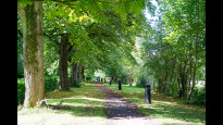
Netherne On-The-Hill, Tue 7 May
19°
Partly cloudy
Tackle a Slow Way today!
Netherne On-The-Hill’s Slow Ways starting point
Grid ref
TQ2953856298
Lat / Lon
51.29109° / -0.14362°
Easting / Northing
529,538E / 156,298N
what3words
Facilities
Users have reported that the following facilities can be found within 1km of Netherne On-The-Hill's meeting point
Public toilet
Wheelchair accessible toilet
Supermarket or convenience shop
Restaurant, cafe or pub
Accommodation
Accommodation for under £50 a night
Campsite
Bothy
Free wifi
Mobility scooter hire
Off-road wheelchair hire
Disabled Parking
Train station
Bus stop
Ferry
Official ‘Walkers are Welcome’ town
Help us improve this information by signing up or logging in and carrying out a quick survey of Netherne On-The-Hill